If Thetford is the gateway to Norfolk, then Croxton is the gateway to the best riding to the north of the town. You pass through it on two of the routes from the town and it’s on the Rebellion Way tour of the whole county as well as National Cycle Network 13.
Those blue signs make it easy to find the start of our outing from the town centre and straight onto the gentle climb out through the suburbs. Then it’s under the main road underpass and into the countryside to the picture-perfect medieval village itself, complete with 13th century round tower church and gorgeous cottages.
Stanford Training Area
Rather than peeling off right following NCN 13, we continue down and then rise up again with the dense woodland of Croxton Heath on the right. A couple of km later we reach the red signs that mark the lower edge of the Stanford Training Area. This huge 30,000-acre expanse of military ranges includes five ‘lost’ villages whose inhabitants only had three weeks to leave when the army took over the whole landscape in 1942. There’s also a sixth ‘battle village’ purpose built and regularly modified to reflect the current operational areas of UK forces.
While you must absolutely obey the no entry signs along the perimeter - and prepare for sounds of live firing or even battalion-sized parachute drops – when the red range flags are flying, ‘Stanta’ has been a tranquil neighbour whenever we’ve ridden in the area.
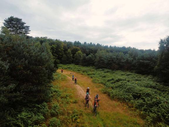
The sensation of wildness and isolation that are the signature of the outward leg of this route really ramps up as you turn north onto the first section of forestry track. Then it’s back to the edge of the training area to pass West Tofts camp on a quiet but broad back road. There’s an opportunity to turn left here and divert a couple of km to the fascinating neolithic and later prehistoric flint mining site of Grime’s Graves.
This ancient industrial hotspot is now in the care of English Heritage and visitors can use ladders to enter some of the more than 400 vaulted mining shafts. From where tens of thousands of tons of material were removed with just antler picks and shoulder blade shovels before being formed into the cutting-edge cutting tools that made this area a ‘Silicon Valley’ of the UK 4,000 years ago.

Lynford Arboretum
Carrying on, our Lone Ranger route takes you north into a particularly beautiful section of the forest at Lynford Arboretum. Here you’ll find toilets and a lovely coffee shack that’s open most of the year so perfect for a pick me up if you need one. The trails in the area are well worth taking the time to explore too, particularly in spring and autumn when the various tree species, woodland flowers and rare fungi are at their finest.
If the heathland and scrub here feel particularly timeless then you might not be surprised that the Lynford Quarry ponds are an extremely important site from 64,000 to 67,000 years ago. At that time Neanderthal hunter-gatherers were making flint tools and using them to hunt and butcher deer, bison, horses and even woolly rhinos while trying to dodge bears, wolves and hyaenas.
Thankfully it’s a lot safer nowadays – but do be careful on the bike though as it’s very popular area with walkers, often with dogs and children in tow. There’s no formal path marking either so it’s just a case of ‘sort of heading right/east above the lakes’ after you cross the access road.
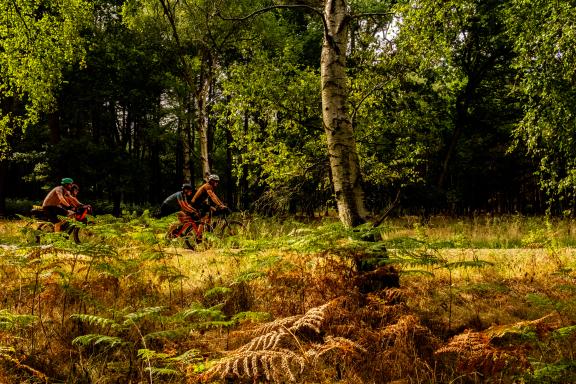
Once you’ve found your way onto the road at the edge of the training area, follow it north to the sharp turn in the road where we disappear into the woods again. This time on narrow grassy singletrack where you’re likely only to have deer, hares and birds for company.
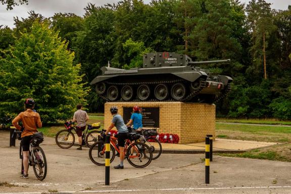
Don’t get too blissed out on its bucolic nature though as you’ll need to be careful crossing the main road at Shakers Wood. Not least because your attention might be diverted by the Cromwell tank mounted on a stone plinth to commemorate the 7th Armoured Division or ‘Desert Rats’. They were one of many units stationed in the area prior to the D-Day invasions of Europe; the remote woods were also used to test the very first ‘tanks’ in 1916.
You can still see – and visit – some of the remaining wartime buildings, and you’ll turn uphill on old concrete military road slabs, but you’ll soon be lost in either silence or birdsong again as the forest cloaks you for a final time.
If you’re gagging for refreshment at this point the pubs at Oxborough and Gooderstone are just a couple of km to the west and Cockley Cley with its early church is just to the north. That’s the way to continue the Rebellion Way towards Swaffham and its selection of routes too.
The Cressinghams
We’ve deliberately kept the first half of this route as remote in feel as possible, so look out carefully for the entrance to an ancient hedged drove road which will take you along a fantastic ribbon of sandy singletrack for several km. Cross the A1065 at Rowley Corner and then roll over the River Wissey into Great Cressingham with its old priory and moated manor.
Then it’s into Little Cressingham with its combined wind and watermill (one of only two in Norfolk) and Grade I ruined church and along the B road into Watton. In most situations you’d think Watton was just a quiet market town in the middle of Norfolk but after several hours of very remote riding it’s likely to feel like downtown Vegas. What it lacks in casinos it makes up for in a variety of shops – the Watton Bakery is home to the largest cheese sandwich I’ve ever eaten – and cafés that are ideal for winning big on the calorie jackpot ready for the return route home.
If your legs are feeling empty too, you’ll be pleased to know that not only are you over two-thirds round at Watton but the going is both easier and less meandering on the way home.
Taking the back road out of town you roll through Merton with its typically Norfolk round tower church and moated manor and then past the Hall of the Baron of Walsingham. This all feels exactly as timeless as it sounds, and then it’s further back into the ages as you join the route of the Peddars Way Roman road at a junction overlooked by a prehistoric burial mound.
You follow this ancient alignment south to Stonebridge where it continues to become part of Route 2 from Thetford if you want to extend your adventure. Be careful on the short section of main road through the village (or push along the footpath) before heading east through East Wretham and then south into Croxton Heath Forest back to Croxton itself before retracing the start back into town.

Disclaimer
All routes are followed at a rider’s own risk. These routes are intended to be general guides: please observe all road signs, waymarks and other specific on-route instructions. Neither Cycling UK nor individual route authors can be held responsible for any errors or consequences that arise from using this route information. Essentially: go out, be sensible, have fun. If you believe there is an important issue with this route then please report it using the button below.

Supported by

