There are seven A roads radiating out into the surrounding area and the B road into the forest is too fast and narrow to comfortably ride on. This is why - despite our best efforts to try and find a way to escape the traffic – route two also sneaks north out of town under the A1066 and then under the A11.
It’s not the most beautiful or inspiring climb out through the suburbs, but that all changes as you roll down into Croxton. This picture-perfect village squeezed into a gap in the massive area of Thetford Forest sets the scene for the rest of the route, complete with signature round tower church and stone and flint cottages and farm buildings.
Then it’s back running alongside the deer, rabbits and whatever else is squeaking, squawking and singing in the dense woods to your right. Next you get to the southern edge of the massive Stanford Training Area that we’ve described in detail in Route 1.
Whether you care about deserted villages and military manoeuvres or not it’s time to turn right to get the forest on both sides and squeeze between the charming sounding Devil’s Punchbowl and Fowlmere lakes. These are both rare examples of artesian ponds where the water rises and falls seemingly totally independent of recent rainfall.
The Punchbowl is also surrounded by a ring earthwork with Mickle Hill burial mound just to the south, adding to the history and mystery of this haunting spot that’s well worth a quick diversion south to take in.
A few hundred metres afterwards you come to a T junction. Go north and you’ll dodge the next off-road section and link up with the plan just to the east of Wretham military camp.
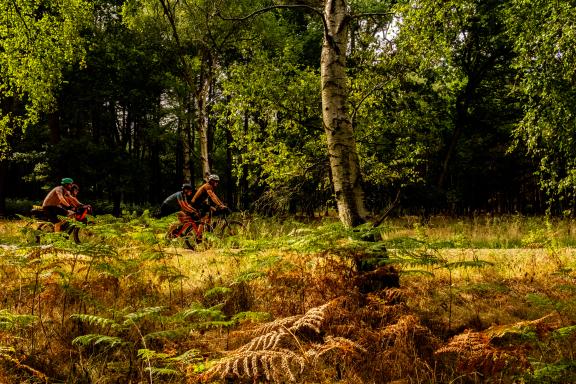
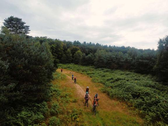
Intrepid adventurers should head straight into the forest in front of them though (there are actually two parallel paths at the start). The good news is that the sandy tracks drain very quickly so they’re relatively rideable even in winter or after a wet spell. The bad news is that in summer it becomes a proper challenge fighting through the deep shifting sand in places and I can certainly confirm that it’s a workout on a tandem in 35º heat.
East Wretham
While the depth of sand and ease of progress fluctuate frequently, the woodland surroundings are consistently beautiful so be sure to stop and look around to appreciate them properly. By the time you get to the more open area of East Wretham with its nature reserve and Site of Special Scientific Interest you’ll have seen plenty of the large flint nodes that made this area so popular among stone age inhabitants too.
The earthworks that marked their burial sites and boundaries are clear in the primeval Breckland fields of East Wretham where you scuttle quickly across the A1075. Then it’s back into dense forest on much easier gravel going, crossing the curve of a disused railway line before you arrive at the still live railway line. Given that it’s listed as a cycle and walking route and we ultimately want to be south of the A11 we’d advise against crossing the railway and then trying to cross the A11. We didn’t have to stare at the dual carriageway of continual traffic racing to and from Norwich and the coast for long to rewrite the route and head north instead.
The extra bonus of that approach is that it means you get to spend a lot longer on the ancient route of the prehistoric and Roman Peddars Way. Losing yourself in the possible stories of the thousands of years of people walking, wheeling and trotting this exact same route before you. You can even follow the path north to join Route 1 towards the Cycling UK EXPERIENCE hub at Swaffham and then continue right to the coast at Hunstanton (another Cycling UK EXPERIENCE hub).

English whisky
That would be a historic adventure in itself, though, so we’re turning right on a quiet back road between wide open fields for around 4km before heading south under the A11. Be careful on the first section to the village though as you’re heading towards a busy industrial estate and its traffic at this point. Keep straight on and you’ll arrive right on the doorstep of The English Whisky Company distillery. It’s the oldest registered whisky distillery in England and the birthplace of several award-winning single malts and blends with a shop, tours, experiences and tastings that earned it a ‘Best of the Best’ Travellers’ Choice award from TripAdvisor.
East Harling is the biggest village on the route and the place to relax, refuel and top up your pockets with snacks for the return journey. Within a couple of km of leaving the village (on the alignment of another Roman road) you’ll be heading back into the forest at an ancient five-way junction again overlooked by prehistoric burial mounds.
Heading into the heart of the woodland again on the road, you turn right onto a broad sandy forest trail that rolls you quickly to a tiny double arch bridge over the winding River Thet. This marks the end of the last section of off road so it’s well worth a stop on the riverbank here to really appreciate the wonderful deserted woodland areas and historical experiences you’ve had along the way. Then it’s time to roll the last few rise-and-fall road km to Kilverstone Hall garden centre on the edge of Thetford.
It’s here that you take the dive through the hedge onto the bike path we talked about in the intro. Make sure you cross the first road and continue straight on down the gravel bike path too, as that’ll put you in the right spot for crossing the main road safely. Then it’s a quick roll down to Milford Common and the parkland around the massive moat and mound of Castle Hill from where the Normans once ruled the area. From here roll south around the castle through the narrow medieval streets of old Thetford back to the marketplace.
Disclaimer
All routes are followed at a rider’s own risk. These routes are intended to be general guides: please observe all road signs, waymarks and other specific on-route instructions. Neither Cycling UK nor individual route authors can be held responsible for any errors or consequences that arise from using this route information. Essentially: go out, be sensible, have fun. If you believe there is an important issue with this route then please report it using the button below.

Supported by

