Note: This route can be started in Otford where a bridleway and back roads deliver you to the nearby Kemsing village, or you could start in Kemsing itself, where there is a free car park.
Kemsing
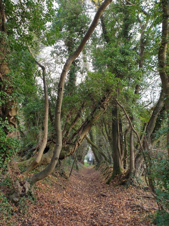
Heading out of Otford, past the train station the route heads down the aptly named Tudor Drive, where the matching white mock Tudor houses with dark wooden beams line the roadside. After an easy-to-miss turn off here, the path guides you between the houses, for a quiet back way route to the village of Kemsing. The route heads south from here on a winding country road, where you cross over the valley bottom, and climb back up the far side, entering the woods which plunge you into the dark woodland. It's exactly the situation where flashing (daytime) bike lights are well worth having. A little patience and care might be needed to cross the A25 road, but you’re soon straight back into quiet country lanes with high banked sides, like that of a Holloway.
Holloways come from the anglo-saxon word which means ‘sunken road’ dating back from 300 years ago, but some far back as the Iron age. Usually starting life as a little drover track to move cattle between farms and markets or as pilgrimage routes, the main path gets worn down in areas where the bedrock is soft, leaving it with high banks either side of the road.

Ightham Mote
There are some bridleways tracks that run through this woodland, but they can be very hard work to cycle as they are soft, whereas the road ahead, descending the far side of the hill is a smooth, fun sweeping descent. Shafts of light penetrate the beach trees canopy, speckling the ground with dappled light, while pretty green moss greedily tries to cover the trees and road bank. A nice bridleway leads you between fields and orchards before plunging downhill through the woods, where you need to stay alert and ready for some log steps along the way, for a fun descent to the grounds of Ightham Mote (pronounced ‘item mote’). This property, now in the hands of the National Trust, was spotted by the wealthy American Charles Henry Robinson, who happened to cycle past it in the 1920’s and vowed he would one day own it. And that he did, 30 years later.
Ightham Mote is a medieval moated manor house, and was described by John Newman, an architectural writer, as “the most complete small medieval manor house in the country”. Previously owned by Medieval Knights, courtiers to Henry VIII and high-society Victorians, this 14th century house has 70 rooms around a central courtyard with serene gardens to explore. Now a National Trust property, it offers you the chance to explore over 700 years of history, and of course means it has a good café attached too.
Plaxtol
Beyond Ightham Mote you climb via bridleways through fields and crops, but bypass the heavily rutted tracks through the orchard, into the village of Plaxtol where there is a great pub, the Papermakers Arms. Continuing on the route, now northbound, a lovely old sunken lane winds its way through the quiet countryside passing oak beamed cottages with traditional leaded glass diamond windows from Tudor times (1479-1607) when glass couldn’t be made in large panes. By a more modern oast house you may wish to check if The Golding Hop Tea House you’re passing here has re-opened. Continuing between the orchards, a fun off-road descent between the tangle of intertwined trees leads you down into a wooded valley bottom where wildflowers can add some colour to the dark woodland floor. More quiet tracks and tarmac lanes eventually deliver you to Wrotham Heath, where after negotiating the busy A road crossing, you are straight back into idyllic countryside, following a lovely lane to Addington village, home to some burial sites/long barrows.
Long barrows are elongated mounds used as burial chambers, constructed in the fifth and fourth millennia BCE, during the Early Neolithic period. The long earthen tumulus, or "barrow" being flanked on two sides with linear ditches, usually between 20 and 70 metres in length. These monuments often contained human remains so thought to be tombs, but some examples show this may not always be the case.
North Downs Way
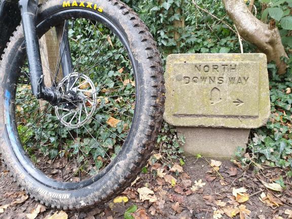
Crossing over to the north side of the M20 motorway now, the countryside morphs from the changeable, steep wooded trails of the south, to a more rolling and open countryside and crops to the north. After following some good farm tracks along the lower slopes of the North Downs hillside, a short climb elevates you part-way up the hill for lovely views and a great trail heading westwards through a long tunnel of trees. It’s a great section of trail and forms a part of the new North Downs Way riders’ route, opened in late 2022, which stretches for 246km (153 miles) from Farnham to Wye, via Canterbury and Dover. This in turn also links to the other long-distance cycle routes of the Cantii Way and King Alfred’s Way, providing all manner of possible adventures.

Trosley Country Park
This route soon descends off down the hillside, to deliver you to Coldrum Long Barrow, the finest and most complete of the Medway megalithic monuments, and early Neolithic burial site (3985-3855 BC). Rejoining the North Downs Way trail there is an option to test your climbing prowess, with a steep ascent up the road to Trosley Country Park. Home to 170 acres of beautiful woodland and chalk downland with a variety of waymarked walking routes, some of which are open to careful cyclists too, this makes it a pleasant place to head to and extend your ride if you wish. As well as to visit the nice café there, serving delicious homemade food. With play areas and picnic spots it’s also a good place to head for an easy, short family ride too.
Our route continues along the foot of the hill, avoiding any additional climbing, following nice off-road trails along the Pilgrim’s Way, which continue after crossing over the M20. Now running parallel with the M26, the route jinks past the grand estate of St Clere Estate. An upgraded tarmac track in-front of the stunning building now allows bicycles along it, where you can enjoy sights of this grand house, which is a popular filming location for films and TV series such as Gangs of London. The gentle gradient and quiet tarmac roads remaining now provide an easy warm down to the ride, delivering you back to the village of Kemsing, where there is a nice café or pub to choose from for your post-ride refreshments.
In the area:
Well worth a visit for the panoramic views alone – this 16-hectare reserve includes ancient woodland and secondary woodland and scrub with areas of chalk grassland on the south facing slopes. Much of the downland has been lost, but there are still four open glades that are managed by winter mowing and by rabbit grazing.
Disclaimer
All routes are followed at a rider’s own risk. These routes are intended to be general guides: please observe all road signs, waymarks and other specific on-route instructions. Neither Cycling UK nor individual route authors can be held responsible for any errors or consequences that arise from using this route information. Essentially: go out, be sensible, have fun. If you believe there is an important issue with this route then please report it using the button below.
Supported by

