Route overview
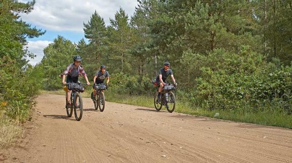
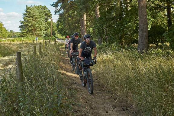
The first route from the Diss Experience Hub is for more adventurous riders on off-road capable bikes. Like most of Norfolk there are no nasty hills and the off-road sections certainly aren’t dangerous in any way. The sandy sections through the forest can be challenging to ride in very wet or very dry conditions though so it makes sense to wear shoes that are OK to walk in.
From Diss it heads west towards Thetford past nature reserves, river meadows and Roman Roads to the beautiful eastern edge of Thetford Forest on off-road ‘gravel’ trails. Pedalling past prehistoric sites and beautiful farms you enter the historic town of Thetford on a traffic free cycle path. Looping round the dramatic Norman castle mound takes you to the market place and shopping area which are a perfect place to rest and refuel for a while.
The homeward leg of our route avoids the busy roads around the town by heading north through beautiful medieval villages before turning east into the forest again. Sandy tracks through the trees link mysterious ancient sites and the unique meres of this fascinating nature rich area. The deep human history of South Norfolk is reinforced again as you follow the Hereward Way to the Roman and prehistoric road of Peddars Way north before looping south to sneak safely under the main road to Norwich. Then it’s a meander through picture perfect villages and stories of Royal intrigue and tragic incidents involving potential US presidents flying from secret airfields. Then it’s time to roll back into Diss itself and make full use of its many foodie delights and useful amenities.
Sandy Lanes
Starting from the centre of Diss it’s up the climb past the pretty Georgian market square and tiny but very active theatre to the T junction at the top. Turn left down the hill and over Denmark Bridge, where crossing the River Waveney takes you over the Norfolk/Suffolk border too. Turn immediately right after the bridge to join National Cycle Network 30 across the primeval heathland nature reserve of Wortham Ling. Then you’re following quiet meandering farm lanes past ancient farms and manor houses of this wonderfully fertile river valley to Theltenham. Turning north at the remains of the ancient cross you’ll roll gently down past the beautiful restored windmill and across the ford to Blo Norton where sand centred back roads skirt old oak woods. The vibrant village shop and adjacent coffee hut at Garboldisham are a fantastic friendly place for a caffeine pick up and pocket filling spree. Then it’s carefully across the A1066, turning immediately left to pass the ancient church and then join the first section of off road along Sandy Lane track.

Prehistoric barrow burials overlook the 5 way junction at East Harling Heath where our route crosses one of the many Roman Road alignments in the area. It’s where the route joins National Cycle Network 13 through the first of several sections through Thetford Forest too. As lovely as the quiet, broad roads and the real forest bathing bliss starts are you turn north onto the gravel of Bridgham Lane popping out of the trees to cross the River Thet. It’s back onto the road for a few km to Kilverstone Hall where you need to look out for the grassy diversion onto a cycle path that lets you dodge the busy road by the supermarket and take you into the old town of Thetford traffic free.
It’s well worth rolling across the grass of Melford Common to take a close up look at the impressive ditch and high mound remains of the Motte and Bailey earthworks of Castle Hill. Back on the bike you loop south around the castle through narrow medieval streets and round to the market place and pedestrianised town centre. At halfway round the loop and with lots of cafes and shops to choose from it’s an ideal place to refuel and relax a while before the northward return leg.
Devil's Punchbowl
Use the signs for NCN 13 to help ease your navigation north, climbing gently (it’s Norfolk remember) to cross the A1066 and then the A11 before rolling down into the beautiful village of Croxton. While NCN 13 peels off right just after the village, we carry on straight, climbing gently again to a T junction. Turn right past the mysterious round earthwork and pond of the Devil’s Punchbowl. Who built the surrounding earthwork and when is unknown but the ‘Devilish’ aspect comes from the fact this SSSI is one of the several ‘fluctuating meres’ in the area. These ebb and flow in size and depth based on underground sinkholes not recent rainfall creating a unique and fascinating environment that’s well worth a visit by turning off at the forest track sign marked ’64’.
Hereward Way and deep sand
Back on the road head east to the next T junction where you join the Hereward Way and things get a little trickier. That’s because the sand tracks of Thetford can become really deep in summer so it’ll take a fair amount of power and skill to keep your pedals going round and your front wheel straight. If you don’t want to struggle though, just hop off and push and literally take the beautiful woodland scenery in your stride. If the whole idea of deep sand puts you off then turn left at the start of the forest and then east past Wretham army camp to stay on quiet roads and rejoin the route at the Peddars Way crossing.

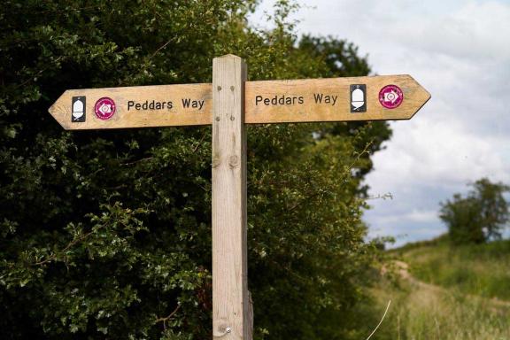
Back to the off piste option once you cross the A1075 main road carefully and then it’s easier, more open off-road riding across Wretham Heath and then back into the forest to Shadwell Crossing. Incidentally if you’re looking at the OS maps for this area, you’ll see several tempting bridlepath options heading south. However, having scoped them out in person the unprotected crossings of the very fast A11 dual carriageway aren’t something we want to encourage. Hence, we’re taking you north up Peddars Way, a 46-mile trail on the line of ancient prehistoric and Roman road that heads all the way to the north coast and is part of the Experience Hub routes from Swaffham and Hunstanton further north. We’re only on it for a couple of km but it’s enough time to lose yourself in the amazing depth of history that runs through this part of south Norfolk and wonder what wheel and sandal tracks you’re following in.
English Whisky
Then it’s a chance for an easy mile or so to catch up on snacks and drinks on the fly as you head towards a safe, bridged crossing of the A11 and south towards Harling. This also takes you straight past The English Whisky Company which is the oldest registered distillery in England and well worth a visit for a tour or to pick up a tipple to toast your ride. Whisky warmed or not it’s time to roll through more of Norfolk’s signature ultra fertile farmland under vast skies troubled by a lot less rain than the rest of the UK and generally a few degrees warmer as well. Kenninghall village was a hotbed of Tudor intrigue and treason during the Reformation with both Mary and Elizabeth living here before they became Queens. Now though it’s a tranquil, traditional village with a well stocked shop and welcoming pub of you need some food and drink for the final furlong.
Just a few km on you pass another site involving secret tragedies and future world leaders as the route skirts the south edge of Fersfield airfield. This remote base was home to multiple experimental trials and secret missions during World War II but the most infamous involved remote-controlled bombers packed with explosives. These flying bombs still needed human pilots to get them airborne though and it was while launch piloting one mission that JFK’s elder brother Joe Kennedy was killed. An incident so physically and politically damaging that the exact circumstances are still a secret.
The quiet sandy back lanes across Bressingham common echo to nothing more than tractors and birdsong these days though, creating a peaceful pastoral backdrop to the route’s winding return into Diss town centre.
Disclaimer
All routes are followed at a rider’s own risk. These routes are intended to be general guides: please observe all road signs, waymarks and other specific on-route instructions. Neither Cycling UK nor individual route authors can be held responsible for any errors or consequences that arise from using this route information. Essentially: go out, be sensible, have fun. If you believe there is an important issue with this route then please report it using the button below.

Supported by

