This route 82km route takes you across farmland, through woods and sandscapes into the hidden gem that is Kings Lynn before moving north on urban cycle paths to the conservation village of Castle Rising. You’ll then roll through parkland to the King’s country residence at Sandringham.
From here, the route heads onto the Roman road based Peddars Way National Trail before turning south to Castle Acre. This picturesque medieval village is bookended by huge castle earthworks at one end and the extensive ruins of a Cluniac Priory at the other. Roll out though a portcullised Medieval gateway and over or through an idyllic ford for the final minimal traffic miles home along the Peddars Way, empty roads and a secret bridleway sneak into Swaffham.
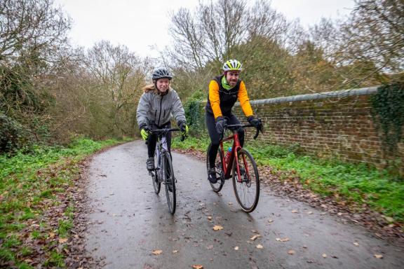
While there’s nothing technically challenging, a lot of the route is on grass and dirt covered Roman roads and farm tracks, so is designed to be ridden on a gravel bike or hybrid bike with sturdy tyres or mountain bike. The flint and sand geology means it’s rideable all year round and because it’s Norfolk there are no steep climbs or descents to worry about either, leaving you free to soak up the beautiful views across the Brecklands landscape with its rich history and abundant wildlife. You don’t necessarily need off road experience - just a bit of stamina - to enjoy it.
This is one of three routes starting from the Cycling UK EXPERIENCE Hub in Swaffham. Have a look at the other routes: Downham Market and Dereham.

Swaffham Market
The route starts from the Swaffham market square, which can often be busy on a Saturday, and then heads north out of town - be careful here of the pedestrian crossing and a short stretch of relatively busy road.
Then it’s onto a quiet back road with a view of the EcoTech Centre and its wind turbines as you climb gradually north to a wood. Keep a keen eye out for a slightly overgrown but signposted bridleway entrance on the left, follow that to join the grass covered alignment of the Roman road. Head west, taking care as you cross the main road, then further west before turning north following ancient tracks and broad, flat and fast gravel farm tracks. Don’t be surprised if you get a 617 Squadron attack jet escort overhead as RAF Marham is a busy base.
Gravel and sand
There’s a slightly convoluted bridleway hook round Eastgate farm followed by a mix of wide-open gravel and sandy lanes taking you over the River Nar and then onto a World War II concrete road to Pentney past the ancient cross and wildfowl filled lakes of the leisure park. There’s a ten metre scuttle along the pavement of the A47 at West Bilney with its beautiful ancient church, before splitting off onto grass strip centre back lanes past a WWII ‘pill box’ fortification near the crossing of the main road. Soon you’ll be heading through the amazing woodland beach and deep blue lake landscape of the old sand quarries of Leziate Country Park.
Kings Lynn
Cross the A149 ring road using the cycle path segments on the roundabout and then ride through the suburbs of Kings Lynn to join the gently meandering and wide multi use path into the town centre - being careful to dodge the trees that are in the middle of the path. The Walks in St James End is an English Heritage grade II historic park, it includes the charming ancient building of the Red Mount and other ancient ruins. The riverfront and centre of Kings Lynn are very much alive with historic warehouses, the beautiful Guildhall where Shakespeare and his players once visited, along with other gems from this extremely rich and important port which was part of the European Hanseatic League. By using National Cycle Network 1, the exit from Kings Lynn is traffic free through the affluent village of Wooton before turning east across the wooded common towards the conservation village of Castle Rising.
Ramparts, royalty and Romans
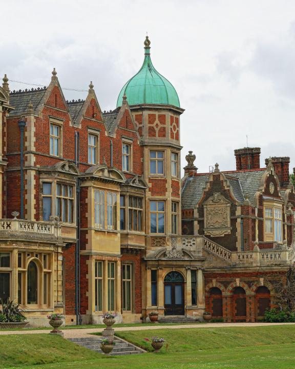
With its picture-perfect houses and large church, Castle Rising would be worth a stop anyway but the massive earthworks and beautiful preserved square keep of the castle are an absolute must see. You leave the village on traffic free roads through the ancient deer park to the edge of the Royal Park at the King’s country residence of Sandringham. Then it’s a suitably regal roll through woodland and heath to the tearooms, gift shop and Sandringham House itself.
Once you’ve had tea with the King you take the tree lined Kings Avenue east past the Royal Stud to meet the Peddars Way long distance path. Prehistoric barrows point to a much older origin with a Roman road superimposed on top, this straight double track gently roller coasters south past timeless farms. It also makes navigation super easy, so you can take your eye off the GPS and fully appreciate the hedgerows full of birds and flowers across the wide-open fields around you.
Amazing acres
Peddars Way also leads you straight to the amazing Norman planned settlement of Castle Acre, where the entire village lies inside the huge outer Bailey of its moated defences. The beautiful old houses are bookended by the ruins of a huge Cluniac Priory at the other end too, which you can view with a slight detour over the broad ford (don’t worry there’s a footbridge as well) you cross to leave this wonderful site. From here you can actually divert back to the Roman road you left on, but the full route hooks past the deserted village of Palgrave and onto one last section of Peddars Way. Then it’s a bridlepath sneak under the A47 and along a wooded path to bring you back into Swaffham.
Disclaimer
All routes are followed at a rider’s own risk. These routes are intended to be general guides: please observe all road signs, waymarks and other specific on-route instructions. Neither Cycling UK nor individual route authors can be held responsible for any errors or consequences that arise from using this route information. Essentially: go out, be sensible, have fun. If you believe there is an important issue with this route then please report it using the button below.

Supported by

