Route overview
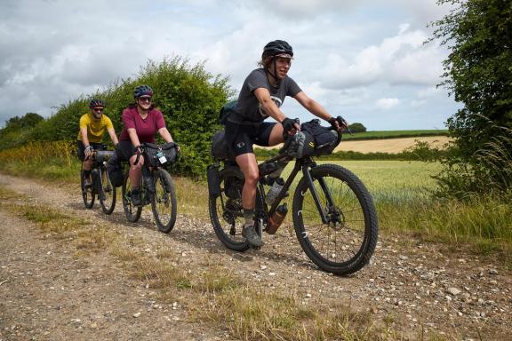
It may be short and link up places that few people have ever heard of but this short, on and off-road loop north east of Diss is a truly charming hidden gem. It’s length and flat topography make it suitable for all riders who are adventurous enough to consider getting their tyres a bit dirty too.
It takes you in a completely different direction to the other two routes from the Diss Experience hub as well, heading out of the town centre eastwards onto the Anglian way. You soon swing north though, jinking along roughly parallel to the Roman Road to Norwich. Sandy centred single track back roads and broad all-weather farm tracks link together past ancient trees and farms to take you to the village of Tivetshall. Here you’ll take a leisurely lap of the villages scattered layout to visit the churches of St Mary and St Margaret. Bird busy copses and prosperous farmsteads are your companions for the next couple of back road kilometres then it’s up and over the London to Norwich railway and into the charming village of Gissing. Then it’s on to Burston with its fascinating modern social history before taking the final section of off road singletrack down a tunnel of trees before the final kilometre into Diss.
Ford crossings
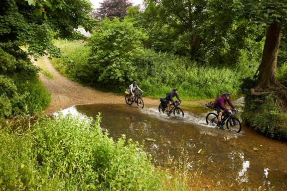
Starting from the Diss centre we head due east towards and under the railway bridge at the edge of town. Be ready to take the bridleway on the left immediately after the arch though where you’ll swap quiet suburbia for a double track across grazing pasture. The right angle turn to the stream gives you two choices depending on weather and warmth. If you don’t mind getting your feet wet you can splash through the pretty ford and power up the gravel bank on the far side. If you’d rather keep your socks dry though take the footbridge to the left. This is narrow though so if you’re on a tricycle or other wide ride the ford is the way forward.

Immediately after the ford is the first point of historical interest at Frenze Hall. The Hall itself is a Grade II listed long hall with an early 17th century half timbered structure at its heart. Unfortunately, that’s been hidden by a brick facade added by its 19th century owner, who also - you guessed it - had a brick making business he was clearly very proud of. The really fascinating building here though is the tiny St Andrew’s church sitting wonkily in the corner of the farmyard. Its tower is long gone and the walls lurch outwards even with the support of large stone buttresses but gently opening the door reveals an amazing time capsule. That’s because this tiny church has seven medieval brasses commemorating local gentry and dating from 1475 to 1521. The stone altar slab (or mensa) probably dates from even earlier while a Stuart Royal emblem painted on wooden boards hangs opposite the door. Look carefully and you’ll see the carvings of two wise old monkeys watching you and the passing of time in this amazingly preserved time capsule.
Two churches
From Frenze it’s a short loop south past a large converted mill before turning north up singletrack roads past large farms reminding you what a prosperous and fertile landscape this has been for thousands of years. Ancient halls, moated manors and another forgotten church dot the landscape of rich crops under Norfolk’s typical endless skies as you meander towards Dickelburgh. This was named after Dicul, a 6th century Irish monk who set up a settlement here that was mentioned by early religious historian Bede in the 7th century. It’s a relatively unremarkable village now though and the wrong side of the main road so while you can visit, if you want the official route stay this side of the A140. At the end of Shimpling Road you’ve got the option to turn left and head straight to Burston which short cuts the route to just over 16km. You’d be missing out some of the best sections of the ride though including the broad track north through the wide open fields towards Tivetshall. Before you reach the village, you’ll come to the evocative ivy and undergrowth festooned ruins of St Mary’s Church which is definitely worth a stop and explore. Looping north past the school takes you to the second church of Tivetshall St. Margaret. In contrast to St Mary’s this is a beautifully preserved church complete with a huge painted wooden divider spanning the whole knave. There’s no doubt as to its date either as it carries the Royal coat of arms of Queen Elizabeth I with a dragon on one side and a lion on the other as well as a God save the Queen scroll and ten commandments script underneath.
School protest
The return leg continues the theme of deserted farm roads and rook filled woods - don’t be surprised if hares and muntjac deer stand unconcerned in the hedgerows and fields to watch you pass. This idyllic undisturbed landscape takes you to Gissing where a quick diversion right will take you to the large round towered church. Here you can see the original Norman doorway and tower details saddled with later additions but it’s well worth a look inside to appreciate the medieval pews, carved screen and rare double hammer beam roof.
From Gissing it’s a short roll south to Burston where you’ll find an unassuming looking building set on the edge of the village green. Come close though and you’ll see the walls are covered in the names of individual and group benefactors from all over the world. That’s because this is the home of the Burston school at the centre of the longest running strike in UK history. It actually involved the local children leaving the official school in protest of unfair dismissal of their teacher on the basis of her lighting a fire to warm them and dry their clothes after a storm as they walked to lessons. The fight between the teachers, pupils, parents on one side and local landowners, dignitaries and church on the other lasted from 1914 to 1939. It caused a major shift in the progression and provision of rural education and represents another facet of Norfolk’s notoriously rebellious nature.
A quiet B road takes you to the edge of Diss where you’ve got the option to take a final 700m of off road singletrack under a tunnel of trees or to continue into town on the road. Either way you’ll soon be rolling past the Saracen’s Head pub and St Mary’s church and hopefully some excellent memories of this short but timeless mini tour.
Disclaimer
All routes are followed at a rider’s own risk. These routes are intended to be general guides: please observe all road signs, waymarks and other specific on-route instructions. Neither Cycling UK nor individual route authors can be held responsible for any errors or consequences that arise from using this route information. Essentially: go out, be sensible, have fun. If you believe there is an important issue with this route then please report it using the button below.

Supported by

