Visit the rocky granite outcrop of Helman Tor with its expansive views over the surrounding countryside, the hilltop gravel along the Saints Way, the converted tram track cycleway through the enchanted Luxulyan Valley alongside the River Par, and the peaceful bridleway through Tywardreath Marsh nature reserve, all before the rocky descent into lively Fowey.
Make the most of the many eateries in the popular town before making your ascent out of Fowey and back inland, over the hills to the antiques hub of Lostwithiel. The final stretch takes you past the Duchy of Cornwall Nursery, which hosts an unmissable cafe, and a wonderful road descent to cross the 15th century Respryn Bridge over the River Fowey.
While there are a few short sections of more technical terrain that would probably be preferable on a mountain bike, a gravel bike is well suited to this route as there are many miles of linking lanes too.
The loop starts and ends from Bodmin Parkway train station for easy access via public transport, but if you’re starting in central Bodmin it’s easy to link up to the route using National Cycle Route 3 through the Lanhydrock Estate.

Helman Tor
From Bodmin Parkway train station, you’ll head west straight uphill through the Lanhydrock Estate to start your ride, joining National Cycle Network Route 3. It’s not long before you get a glimpse of Helman Tor, the rocky granite summit surrounded by scrubland and fields of grazing Belted Galloway cattle.
The lanes narrow as you approach, with strips of grass up the middle and ancient, twisting trees reassuring you that this is a spot of Cornwall off the main tourist trail. You ride next to the tor on the lane before reaching a small gravel car park.
Here, if you wish, you can take fifteen minutes or so to hike the last section through the nature reserve to the summit of Helman Tor at 209 metres (686 feet) for even more remarkable views across inland North Cornwall and west to the landscape sculpted by tin and clay mining.
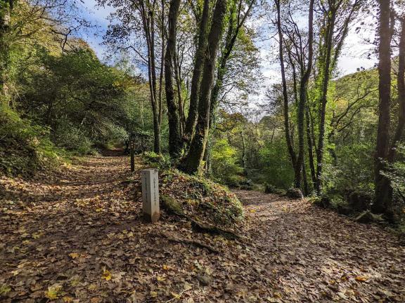
A fantastic stretch of off-road riding follows, along the top of the ridge on the Saint’s Way, a long distance trail that links Padstow and Fowey, thought to be the path of Christian travellers between mainland Europe, Wales and Ireland.
The Luxulyan Valley
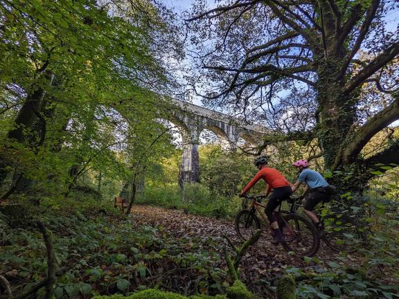
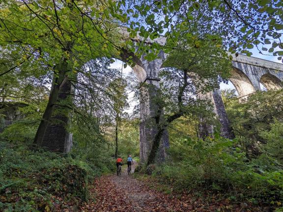
After descending on the narrow lanes, you’re in for a real highlight of the ride: lost to time, the Luxulyan Valley, now part of the Cornish Mining World Heritage Site. Follow alongside the River Par on the gravelly cycleway running along the former horse-drawn mineral tram line, marvelling and the many remnants of mining history, largely the work of Joseph Treffrey.
The ten-arch viaduct that spans the steep-sided broadleaf valley is the most impressive of all the structures, which carried water to power the water wheel at Carmears as well as mine trucks across the valley high above.
While the leats and canal built here do take some water away from the Par, the river still flows with some vigour through the mossy green woodland, strewn with ferns. Keep your eyes peeled for dippers, which can be seen foraging on the rocky riverbed in the shallows here.

Fowey
More lanes, a blissful stretch on a bridleway through Tywardreath Marsh nature reserve and an unavoidable short and downhill section of the main road lead you towards Fowey. Peel off to the right onto Prickly Post Lane to reach Love Lane bridleway for a real blast down into the town if you enjoy more technical riding.
The singletrack starts off more mellow, with a few small step-downs over roots, but towards the bottom the rock slabs get larger and more bumpy. It’s a wonderful way down to the sandy Readymoney Cove, though you may wish to walk a few short sections if you’re on a gravel bike.
A short up-and-over takes you into the centre of Fowey to the Town Quay, where you can find a tempting selection of cafes, pubs and chippies for a well-earned break. The view across the Fowey Estuary faces Polruan opposite, and there are frequent ferries and boat trips should you wish to explore further. You can even take a boat upstream to Lostwithiel (on the right tide) to skip a few hills!
Lostwithiel and the Duchy Nursery
There’s no two ways about it, you must climb to head back inland from Fowey but at least the first half is on the quieter Passage Lane. After the short main road stint you can return to quieter lanes running parallel to the River Fowey, but they are no less hilly!
Another leafy bridleway climb takes you over the last hill before Lostwithiel, a gorgeous town known as the antiques capital of Cornwall, boasting plenty of independent shops and festivals too. Pause to explore the 12th century stannary town, before marvelling at the medieval bridge that spans the River Fowey.
Either enjoy the hospitality in Lostwithiel or save yourself for the Duchy of Cornwall Nursery, an upmarket garden centre and cafe that was originally built as a plant nursery for the Duchy’s many Cornish estates. Expect Bake Off worthy cakes and fine coffee alongside heartier lunches on the menu, all made with local produce.
From the Duchy Nursery, you’re almost finished, with a final bit of climbing on Cott Road offering up magnificent views over the rural valley below before a very long, fairly straight road descent all the way down to Respryn Bridge.
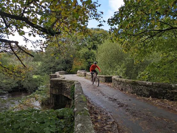
Constructed from granite, the 15th century Respryn Bridge replaced an earlier structure built some 200 years before, and was famously a strategic crossing point during the English Civil War. From here, it’s just a short ride along the cycleway next to the River Fowey back to Bodmin Parkway train station.
If you’re riding out from central Bodmin, you can follow National Cycle Route 3 through Lanhydrock to join the route while avoiding major roads.

Disclaimer
All routes are followed at a rider’s own risk. These routes are intended to be general guides: please observe all road signs, waymarks and other specific on-route instructions. Neither Cycling UK nor individual route authors can be held responsible for any errors or consequences that arise from using this route information. Essentially: go out, be sensible, have fun. If you believe there is an important issue with this route then please report it using the button below.

Supported by

