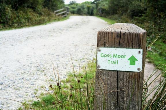
Off-road highlights include the spectacular Goss Moor nature reserve, with its chalky white gravel double and single track multi-use trails, a thrilling descent of the forestry roads through Bishop’s Wood, and a gentle return to Bodmin from Wadebridge along the flat and traffic-free Camel Trail.
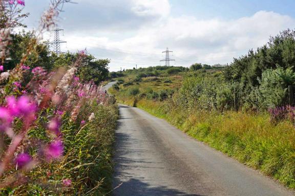
There’s a significant mileage of rural lanes in between these sites, which are anything but flat, though thankfully typically quiet. All that climbing does mean you’ll be rewarded with magnificent views though, so choose a clear day for this ride if you can.
While there are off-road sections along the route through Goss Moor, Bishop’s Wood and along the Camel Trail, these are all pretty well-surfaced gravel, so a sturdy hybrid, tourer or gravel bike would be ideal.
History buffs will delight in the sights en route, with an optional short hike to the impressive Castle an Dinas Iron Age hill fort, and a visit to Cornwall’s largest prehistoric standing stone, the St Breock Downs Monolith.
There’s plenty to see for wildlife lovers too, with a selection of both heathland and estuary species abundant across these varied landscapes and the farmed countryside that links them.

Keen to try some Cornish delicacies on your travels? While most of the route feels pretty remote, avoiding busier coastal hotspots, there are some great places for refuelling. Pick up some saffron buns from the Real Food Garden farm shop after leaving Bodmin, enjoy a proper Cornish pasty from Barnecutts in Wadebridge, and don’t forgo afternoon tea, as served at the Camel Trail Tea Garden close to the end of the route.
Goss Moor
Starting from the free Scarlett’s Well car park on the Camel Trail in Bodmin, you’ll leave the town heading west and warm up on a series of rural lanes. After crossing the A30, you reach the first real gem of this route: Goss Moor nature reserve. Tregoss Moor comes first in fact, with the glorious white gravel track twisting around the open moorland with deep purple heather and bright yellow gorse contrasting in late summer. A short road stint takes you into Goss Moor proper, with the multi-use trail designed to enable hikers, cyclists and horse riders alike to enjoy this quiet inland sanctuary, while still retaining areas of sanctuary for the wildlife. You’re fairly likely to come across the resident Belted Galloway cattle peacefully grazing as you enjoy these wide doubletrack and singletrack trails past the scrub and reedbeds.
Castle an Dinas
Crossing back over the A30 to head north, another section of rolling lanes follows, and you have the option to leave the farm track and hike up the footpath to the summit of Castle an Dinas, an ancient hill fort on Castle Downs dating back to the second or third century BC. Three ditch and rampart rings mark where the fort would have once stood, now believed to be more central to community events, trading and ceremonies rather than military use.
Why not pack a small picnic and enjoy the vast views over Central Cornwall from up here on a clear day?
Rosenannon Downs and the St Breock Downs Monolith
A fairly hefty, yet not too steep, incline awaits as you ride over the cattle grid onto Rosenannon Downs, the last major hillside that stands between you and the Camel Estuary. It feels very remote up here, with far-reaching views over heather and tussocked grass, only punctuated by grazing North Devon cattle.
The reward for reaching the summit is Cornwall’s largest and heaviest prehistoric standing stone, the St Breock Downs Monolith or Men Gurta. Originally standing at five metres tall, the stone is said to weigh over 16 tonnes!
Bishop’s Wood
The serious climbing is now done, it’s time to leave the rugged beauty of these rural areas to head back to civilisation, and a good refuelling in Wadebridge! Yet not before a thrilling fire road descent through the trees at the Forestry Commission’s Bishop’s Wood, almost all the way back down to the River Camel.
Wadebridge offers a fantastic choice of places to eat and refill water bottles, though the Cornish bakery Barnecutts comes highly recommended for pasties, heavy cake and other local delicacies.
The Camel Trail
Now down to river level at the head of the tidal Camel Estuary, the fantastic Camel Trail multi-use trail offers a wide and flat traffic-free link to get you back to Bodmin. Formerly a train line, the stretch between Wadebridge and Bodmin is light gravel terrain, with farmland, woods, meadows and marshes to enjoy as you savour the easy pedal back to your starting point.
The old station platforms have been preserved along the route, and you can still enjoy a short steam engine ride or marvel at the trains at Boscarne Junction.
Don’t pass by the Camel Trail Tea Gardens without stopping on your way back, with a glorious garden to enjoy a proper Cornish cream tea in!
Optional Padstow extension
If you’re keen to extend the route, you can add an out-and-back along the paved section of the Camel Trail next to the estuary to the pretty harbour town of Padstow. This option adds 11.5 miles (18.5 km), with virtually no climbing or motorised traffic.
In picturesque Padstow you’ll find plenty of places for a good bite to eat, as well as fresh local seafood, though both the town and the Camel Trail from Wadebridge is certainly better enjoyed in the quieter off-season between October and May.
Be sure to take your binoculars with you if you enjoy wildlife spotting, as there are often numerous waders foraging on the estuary mudflats beside the trail at low tide, including oystercatchers, egrets, curlew and redshank.
Disclaimer
All routes are followed at a rider’s own risk. These routes are intended to be general guides: please observe all road signs, waymarks and other specific on-route instructions. Neither Cycling UK nor individual route authors can be held responsible for any errors or consequences that arise from using this route information. Essentially: go out, be sensible, have fun. If you believe there is an important issue with this route then please report it using the button below.

Supported by

